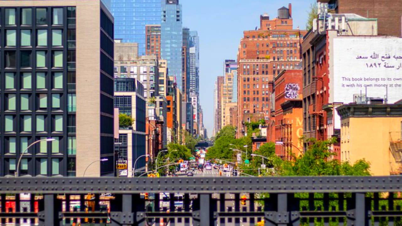
If you’re planning a trip to New York City and want to walk the High Line, one of the first questions you’ll probably ask is simple: where does it actually start, and where does it end? The good news is that the High Line has a clear, walkable route from one tip of Manhattan’s far West Side to the other, and knowing its endpoints will help you plan the perfect visit, whether you want to walk the whole thing or just a scenic stretch of it.
In this guide, we’ll break down exactly where the High Line begins and ends, what neighborhoods it passes through, how long the walk takes, and the best entrances to use depending on where you’re coming from.
Where Does the High Line Start and End
Gansevoort Street to 34th Street
The High Line starts at Gansevoort Street in the Meatpacking District, at the southern tip of the park near Washington Street, and ends at 34th Street on the northern end, near the Hudson Yards development and the Jacob K. Javits Convention Center. From end to end, the park stretches roughly 1.45 miles, covering about 22 to 23 city blocks along Manhattan’s West Side.
That means a walk from one end to the other takes you north to south (or south to north) through three distinct neighborhoods: the Meatpacking District, Chelsea, and Hudson Yards. Along the way, the elevated pathway crosses over streets and avenues including 10th Avenue, giving you sweeping views of the city and the Hudson River as you go.
The Southern Starting Point: Gansevoort Street
The southern terminus of the High Line sits at Gansevoort and Washington Streets, in the heart of the Meatpacking District. This entrance is one of the most popular ways to access the park, largely because of its location. It sits directly beside the Whitney Museum of American Art, making it easy to combine a High Line walk with a museum visit.
This entrance also has elevator access, which makes it a good choice for visitors who use wheelchairs, strollers, or simply prefer not to climb stairs. Nearby, you’ll find the Donald Pels and Wendy Keys Gansevoort Woodland, a shaded garden area with tiered steel planters and seasonal blooms like wisteria and clematis that create a leafy, tucked-away feel right at the park’s entrance.
Historically, this wasn’t always the southern end of the line. The original elevated railway that the High Line was built on top of once continued much farther south, all the way down to Spring Street and eventually to St. John’s Terminal near Pier 40.
That southern stretch of track was demolished in stages starting in the 1960s as rail traffic declined and much of the surrounding industrial land was redeveloped, which is how Gansevoort Street became the park’s true starting point.
The Northern Ending Point: 34th Street
At the other end, the High Line concludes at 34th Street, running between 10th and 12th Avenues near Hudson Yards. This is the newest section of the park and feels noticeably different from the southern end. Instead of low-rise, historic Meatpacking District buildings, you’re walking beneath and alongside the glassy high-rises of the Hudson Yards development, with the Jacob K. Javits Convention Center visible nearby.
The northern end also includes the Interim Walkway between 30th and 34th Streets, a more raw, less manicured stretch that echoes what the entire High Line looked like decades ago, when the abandoned tracks were overtaken by wild grasses and self-seeded plants. If you want a sense of what the original, pre-restoration rail line looked like, this section is worth a slow walk.
At 34th Street, near 11th Avenue, is also home to the CSX Transportation Gate, notable for being the only spot where the High Line touches down at street level along its entire route. The closest subway access here is the 34th Street–Hudson Yards station, making it a convenient starting or ending point if you’re arriving by train.
A Timeline of How the Route Grew
The High Line wasn’t built all at once. Its current start-to-finish route was completed in phases over roughly a decade, which explains why different sections of the park have such different personalities.
- 2009: The first section opened, running from Gansevoort Street north to West 20th Street.
- 2011: A second phase extended the park another ten blocks, reaching West 30th Street.
- 2014: A third phase added the stretch between 30th and 34th Streets, bringing the park to its current northern boundary near the Hudson Rail Yards.
- 2019: The Spur, a short offshoot at 30th Street and 10th Avenue, opened as the final piece of the original rail structure to be converted into park space.
- 2023: The High Line–Moynihan Connector was added, creating a pedestrian link between Moynihan Train Hall and the High Line by way of Manhattan West.
Each expansion pushed the park’s northern boundary further, while the southern end at Gansevoort Street has remained fixed since the park’s opening.
How Long Does It Take to Walk the Whole High Line?
Since the full route covers about 1.45 miles, most visitors can walk from end to end in 30 to 45 minutes at a relaxed pace, not accounting for stops. Realistically, though, most people spend closer to one to two hours on the High Line, since there’s a lot to pause for: garden beds, art installations, food vendors, and skyline views all along the way.
If you’re short on time, you don’t need to walk the entire length in one go. With roughly 15 access points spread along the route, you can join or exit the park at almost any point that’s convenient, making it easy to fit into a broader day of sightseeing in Chelsea or the Meatpacking District.
Best Entrances Depending on Where You’re Coming From
Because the High Line runs through several neighborhoods, the best place to start your walk really depends on your starting point and what else is on your itinerary.
Starting from the south (Gansevoort Street): This is the classic starting point, ideal if you’re also visiting the Whitney Museum or exploring the Meatpacking District’s restaurants and shops beforehand. It has elevator access, so it’s a solid pick for accessibility.
Starting from Chelsea (14th to 23rd Streets): These entrances put you close to Chelsea Market, one of the most popular food destinations connected to the High Line, as well as the Chelsea gallery district. The 14th Street entrance is also near several subway lines.
Starting from the north (30th to 34th Streets): If you’re staying near Hudson Yards or arriving via the 34th Street–Hudson Yards subway station, beginning here lets you walk south, finishing near the Whitney Museum and the lively Meatpacking District, a nice option if you want to end your walk somewhere with easy dinner options.
What You’ll See Along the Way
Regardless of which end you start from, the walk between Gansevoort Street and 34th Street passes through several distinct garden zones and public art areas. Highlights include the Chelsea Grasslands, planted with wild grasses reminiscent of the High Line’s abandoned years, the Chelsea Thicket, and the Philip A. and Lisa Maria Falcone Flyover.
Where the walkway rises above the plantings for a treetop-level perspective. There’s also a dedicated lawn area near 23rd Street, one of the only spots on the High Line where visitors are permitted to step onto the grass.
Practical Tips for Visiting
A few things are worth knowing before you go. The High Line is open daily, generally from early morning until 10 p.m., though hours can shift seasonally, so it’s worth double-checking before you visit. Dogs aren’t permitted on the park (service animals excepted), and outside of the designated lawn near 23rd Street, walking on planted areas isn’t allowed, since much of the landscaping is delicate and intentionally wild.
If you want more context on the park’s history and design, free docent-led tours run several days a week depending on the season, departing from set points along the route.