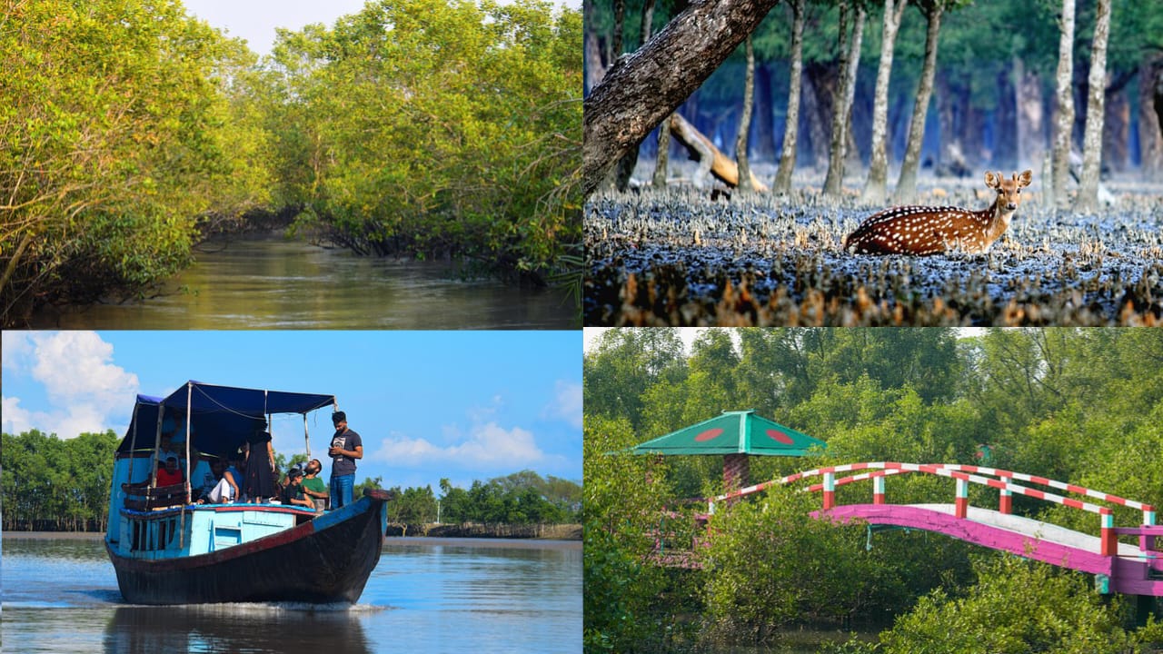
Somewhere along the southern edge of Bangladesh, where the Ganges, Brahmaputra, and Meghna rivers finally surrender their waters to the Bay of Bengal, lies a forest unlike any other on Earth: a labyrinth of muddy channels, tangled roots, and silver-green canopy stretching across thousands of square kilometers, where land and sea never quite draw a clear line between them.
This is the Sundarbans, the largest contiguous mangrove forest in the world, and one of the most biologically rich, ecologically important landscapes on the planet. For most people outside South Asia, the word “Sundarbans” conjures one image: the Royal Bengal Tiger, swimming silently between islands, the only tiger population on Earth adapted to a saline, tidal, forested environment. But the Sundarbans is far more than a tiger habitat.
It is a UNESCO World Heritage Site, a Ramsar Wetland of International Importance, a natural shield against cyclones for tens of millions of coastal residents, a nursery for regional fisheries, and a living laboratory for understanding how ecosystems respond to a warming, rising sea.
This article takes a deep dive into the Sundarbans mangrove forest of Bangladesh its geography and formation, its extraordinary biodiversity, its cultural and economic significance, the mounting threats it faces, the conservation efforts trying to protect it, and practical guidance for anyone hoping to visit responsibly.
Whether you are a student researching wetland ecosystems, a traveler planning a trip to Bangladesh, or simply someone curious about one of the world’s great natural wonders, this guide aims to give you a thorough, human, and genuinely useful picture of the Sundarbans.
What and Where Is The Sundarbans Mangrove Forest?
The name “Sundarbans” is generally believed to derive from the Bengali words “sundari,” referring to the dominant mangrove tree species (Heritiera fomes) found throughout the region, combined with “ban,” meaning forest. In essence, the Sundarbans is literally “the beautiful forest” a fitting name for a landscape that manages to be both stunning and forbidding at once.
Geographically, the Sundarbans spans the delta formed by the Ganges, Brahmaputra, and Meghna rivers where they empty into the Bay of Bengal. The forest straddles the border between Bangladesh and the Indian state of West Bengal, but the majority of it roughly 60 percent lies within Bangladesh, primarily across the districts of Khulna, Satkhira, and Bagerhat. The remaining portion sits across the border in India, where it is managed as the Sundarbans National Park and Tiger Reserve.
In total, the Sundarbans covers an area of approximately 10,000 square kilometers, making it the single largest mangrove forest on Earth. Within Bangladesh alone, the forest spans roughly 6,000 square kilometers, criss-crossed by an intricate network of tidal waterways, mudflats, and small islands that shift and reshape themselves with every monsoon season and every tidal cycle. There are hundreds of islands within the delta, separated by a maze of rivers, canals, and creeks, some barely a few meters wide and others broad enough to be mistaken for open sea.
What makes this landscape so distinctive is its constant negotiation between fresh and salt water. The rivers bring sediment-laden freshwater down from the Himalayas, while tides push brackish and saline water inland from the Bay of Bengal twice a day. This mixing zone creates one of the most dynamic and productive ecosystems on the planet, one where the boundary between land and water is never fixed for long.
The Formation and Geological Story of the Sundarbans
The Sundarbans did not appear overnight. Its formation is the product of thousands of years of sediment deposition from the Ganges-Brahmaputra-Meghna river system, one of the largest river deltas in the world. As these rivers flow from the Himalayas and across the Indian subcontinent, they carry enormous quantities of silt and sediment, which they deposit as they slow down and spread out near the coast.
Over millennia, this constant deposition built up the low-lying, marshy land that would eventually become the Sundarbans delta. The area’s elevation remains extremely low, often just a few meters above sea level, which is precisely why mangrove trees uniquely adapted to tolerate salt water and unstable, waterlogged soil became the dominant vegetation rather than typical terrestrial forest species.
Mangroves have evolved specialized root systems, known as pneumatophores, that project upward out of the mud to allow the trees to breathe in oxygen-poor, waterlogged soil. Many species also have salt-filtering mechanisms in their roots or salt-excreting glands in their leaves, allowing them to survive in an environment that would kill most other plant life. This adaptation is why the Sundarbans could form and flourish where a conventional forest never could.
The delta is also geologically active and constantly changing. Rivers shift course, islands erode on one side while new land forms on another, and the entire landscape is in a state of perpetual flux shaped by tides, monsoon flooding, and increasingly, human intervention and climate change.
Flora of the Sundarbans
The Sundarbans is home to an estimated 334 species of vascular plants, though mangroves and their associated species dominate the landscape. Understanding the flora here is really about understanding a spectrum of trees adapted to different degrees of salinity, tidal inundation, and soil conditions across the delta.
Sundari (Heritiera fomes)
The tree that gave the forest its name, the sundari, is a moderately salt-tolerant species once found in dense stands throughout the region. Its wood is prized for construction and boat-building because of its strength and durability. Unfortunately, sundari trees have been increasingly afflicted by a dieback disease known locally as “top-dying disease,” which has been linked to rising salinity levels in the soil itself a consequence of reduced freshwater flow and sea-level rise. This decline is one of the most visible signs of ecological stress within the forest today.
Gewa (Excoecaria agallocha)
Gewa is another dominant species, particularly valuable as a source of raw material for the local match and newsprint industries in Bangladesh. It tends to grow in areas with moderate salinity and is highly adaptable, which has allowed it to expand its range somewhat as sundari has declined in certain zones.
Goran, Keora, and Baen
Other significant species include goran (Ceriops decandra), which thrives in saline conditions and is often used for fuelwood; keora (Sonneratia apetala), a pioneer species that colonizes new mudflats and river banks, stabilizing freshly formed land; and baen (Avicennia officinalis), one of the most salt-tolerant mangroves, found at the seaward fringes where salinity is highest.
Golpata (Nypa fruticans)
The golpata, or nipa palm, is a low-growing palm species found along riverbanks and creeks. Its broad leaves are harvested by local communities for thatching roofs, and its economic importance to surrounding villages is significant, providing a renewable, sustainable building material.
Zonation Patterns
One fascinating aspect of Sundarbans flora is its zonation the way different species dominate different areas depending on salinity and tidal exposure. Freshwater-influenced zones in the northeast host greater species diversity, while the saltier southern zones nearer the Bay of Bengal are dominated by highly salt-tolerant trees. This zonation isn’t static; as salinity shifts with upstream water diversion and sea-level rise, these boundaries are gradually moving, with real consequences for the species and communities that depend on them.
Fauna of the Sundarbans
If the flora of the Sundarbans is defined by its remarkable adaptations to a harsh, saline environment, the fauna is defined by sheer diversity and the presence of some genuinely extraordinary species found nowhere else in quite the same way.
The Royal Bengal Tiger
No discussion of the Sundarbans is complete without its most famous resident: the Royal Bengal Tiger (Panthera tigris tigris). The Sundarbans is home to the only population of tigers in the world that has adapted to a mangrove swamp environment, and these tigers are unlike their counterparts in the grasslands and forests of central India or Nepal.
Sundarbans tigers are accomplished swimmers, capable of crossing wide rivers and tidal channels between islands with ease. They have adapted their diet to include fish, crabs, and even monitor lizards in addition to more typical prey like spotted deer and wild boar. Perhaps most notably, Sundarbans tigers have a reputation well-documented over generations for occasionally preying on humans, particularly honey collectors and fishermen who venture deep into the forest.
This has given rise to a unique and somewhat haunting cultural relationship between local communities and the tiger, one steeped in folklore, ritual, and genuine caution. Estimates of the tiger population within the Bangladesh Sundarbans have fluctuated over the years depending on survey methodology.
With camera-trap studies in recent years suggesting a population in the range of roughly 100 to 120 individuals, though these numbers are approximate and the subject of ongoing research and periodic tiger census efforts by Bangladesh’s Forest Department.
The Estuarine (Saltwater) Crocodile
The Sundarbans waterways are also home to the estuarine crocodile (Crocodylus porosus), the largest living reptile species on Earth. These formidable predators lurk along riverbanks and in tidal creeks, and along with tigers, they represent one of the few remaining places where humans regularly coexist with large predators capable of preying on them.
Spotted Deer, Wild Boar, and Rhesus Macaques
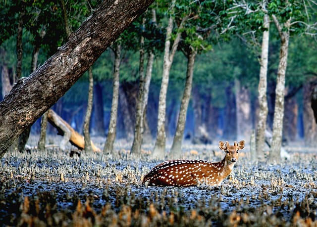
Away from the apex predators, the forest supports substantial populations of chital, or spotted deer, which serve as the primary prey species for the tiger population. Wild boar are also common, along with rhesus macaques, which can often be spotted along riverbanks and near forest edges, sometimes approaching boats in search of food.
Birdlife
The Sundarbans is a paradise for birdwatchers, hosting over 300 recorded bird species, including the majestic white-bellied sea eagle, ospreys, kingfishers of multiple species, herons, egrets, and a wide variety of migratory waterfowl that arrive in the winter months. The forest’s remote waterways and undisturbed mudflats provide critical habitat for both resident and migratory bird populations along the Central Asian Flyway.
Dolphins and Aquatic Life
The rivers and estuaries of the Sundarbans support populations of two dolphin species: the Ganges river dolphin (a freshwater species) and the Irrawaddy dolphin, which prefers more brackish and coastal waters. Both species are considered vulnerable to endangered depending on the specific population, and sightings of these dolphins have become an increasingly popular highlight for eco-tourists traveling through the delta.
Beneath the surface, the Sundarbans functions as an enormously productive nursery ground for fish and crustaceans. The complex root systems of mangrove trees provide shelter for juvenile fish and shrimp, protecting them from larger predators while they mature a role that has enormous economic significance for the fishing industries of both Bangladesh and India.
Other Notable Species
The forest also hosts fishing cats, jungle cats, small Indian civets, otters, and venomous snakes such as the king cobra. Monitor lizards, mudskippers (fish that survive out of water and skip across exposed mudflats at low tide), and fiddler crabs round out a food web as intricate as the waterways themselves.
Ecological and Economic Importance of the Sundarbans
It would be difficult to overstate how important the Sundarbans is, both ecologically and economically, not just to Bangladesh but to the broader region and indeed the world.
Natural Storm Barrier
Perhaps the single most critical function the Sundarbans performs is acting as a natural buffer against cyclones and storm surges. Bangladesh sits in one of the most cyclone-prone regions on Earth, and the dense mangrove forest absorbs and dissipates storm-surge energy before it reaches densely populated inland areas. Studies following major cyclones including Sidr in 2007 and Aila in 2009 have repeatedly shown that areas shielded by intact mangrove forest suffered significantly less damage and loss of life than unprotected coastal areas. In effect, the Sundarbans functions as a living seawall for tens of millions of people in the low-lying coastal districts of southern Bangladesh.
Carbon Sequestration
Mangrove forests are now recognized as among the most effective ecosystems on Earth for sequestering carbon, often called “blue carbon” ecosystems. Mangroves store carbon at rates several times higher than terrestrial tropical forests, both in above-ground biomass and in the waterlogged soils beneath them, where organic matter decomposes slowly and carbon accumulates over centuries. Given its sheer size, the Sundarbans represents one of South Asia’s most significant blue carbon reservoirs, making its conservation directly relevant to global climate mitigation efforts.
Fisheries and Livelihoods
The Sundarbans supports the livelihoods of an estimated several million people who live in and around its periphery. Fishing is one of the primary economic activities, with local communities harvesting fish, shrimp, and crab both for subsistence and for commercial sale. The forest’s role as a nursery habitat for juvenile marine species means that its health directly affects fish stocks far beyond the delta itself, supporting fisheries throughout the Bay of Bengal.
Honey and Wax Collection
A smaller but culturally significant activity is the seasonal collection of wild honey and beeswax by local honey collectors, or “mawalis.” This dangerous work, carried out during a licensed season, sends collectors deep into tiger territory to harvest wild bee colonies. The tradition is steeped in ritual, with many mawalis offering prayers to Bonbibi, the guardian forest spirit revered by both Hindu and Muslim communities, before entering the forest.
Timber and Non-Timber Forest Products
The Sundarbans also provides timber, fuelwood, and thatching materials (notably golpata) that support local construction and small-scale industry. These extractive activities are regulated by permit systems managed by the Bangladesh Forest Department, though illegal logging remains an ongoing enforcement challenge.
Tourism Revenue
Increasingly, the Sundarbans generates revenue through eco-tourism, with domestic and international visitors traveling to experience its wildlife and unique landscape. Though smaller in scale than at other UNESCO sites, tourism is a growing income source for local guides, boat operators, and hospitality businesses in gateway towns like Khulna and Mongla.
Threats Facing the Sundarbans
Despite its ecological importance, the Sundarbans faces an accumulating set of serious threats, many of which are interconnected and mutually reinforcing.
Climate Change and Sea-Level Rise
As a low-lying delta ecosystem, the Sundarbans is exceptionally vulnerable to sea-level rise. Even modest increases in sea level can dramatically alter tidal inundation patterns, increase soil salinity, and submerge low-lying islands entirely. Scientific projections suggest that continued sea-level rise, combined with land subsidence in the delta (a natural process exacerbated by upstream sediment trapping from dams and barrages), could submerge significant portions of the Sundarbans within this century if current trends continue.
Increasing Salinity
Reduced freshwater flow from upstream rivers partly due to dams and water diversion projects in India, notably the Farakka Barrage on the Ganges combined with saltwater intrusion from rising seas, has measurably increased soil and water salinity across much of the Sundarbans. This has directly damaged sundari tree health, contributing to the top-dying disease phenomenon, and is gradually shifting the forest toward more salt-tolerant but less economically valuable species.
Cyclones and Extreme Weather
While the Sundarbans protects the areas behind it, the forest itself absorbs tremendous damage during major cyclones. Storms like Sidr (2007), Aila (2009), Bulbul (2019), Amphan (2020), and Yaas (2021) have caused significant tree mortality, altered forest structure, and in some cases caused lasting changes to soil salinity and sediment patterns. As climate change is expected to increase the intensity, if not necessarily the frequency, of tropical cyclones in the Bay of Bengal, this pressure is likely to intensify.
Poaching and Illegal Wildlife Trade
Despite legal protections, poaching remains a persistent threat to Sundarbans wildlife, particularly tigers (targeted for their skins and body parts, which command high prices in illegal wildlife trade markets) and deer (poached for meat). Anti-poaching patrols conducted by the Bangladesh Forest Department and associated wildlife crime units have made progress, but enforcement across such a vast and remote landscape remains genuinely difficult.
Human-Wildlife Conflict
As populations in villages bordering the forest grow, and resources within it grow scarcer, human-tiger conflict has persisted. Tigers occasionally stray into village areas in search of prey, sometimes causing livestock losses or, tragically, human casualties, while tigers are sometimes killed by villagers in retaliation or fear. Conservation programs have tried to reduce this conflict through measures like nylon net fencing along vulnerable boundaries and compensation schemes for affected families, with mixed but improving results.
Industrial Development and Pollution
One of the most contentious threats in recent years has been industrial development near the forest’s boundaries, most notably the Rampal coal-fired power plant, built roughly 14 kilometers from the Sundarbans’ edge.
Environmental groups, both within Bangladesh and internationally, have raised sustained concerns that air pollution, thermal water discharge, coal ash contamination, and increased shipping traffic could damage the fragile ecosystem, despite government mitigation assurances. Oil spills from vessel traffic have also occurred on multiple occasions, including a significant furnace oil spill in the Shela River in 2014 that affected wildlife and vegetation across a wide area.
Unsustainable Resource Extraction
Illegal logging, over-harvesting of fish and wild shrimp fry (a practice often criticized for its destructive bycatch), and unregulated tourism in sensitive zones all add cumulative pressure on the ecosystem.
Conservation Efforts and Protected Status
Recognizing the immense value of the Sundarbans, both Bangladesh and the international community have undertaken a range of conservation measures over the decades.
UNESCO World Heritage Site
The Bangladesh portion of the Sundarbans was designated a UNESCO World Heritage Site in 1997, in recognition of its outstanding universal value as an ecosystem and its role as a critical habitat for endangered species, particularly the Bengal tiger. This designation has helped draw international attention and, to some degree, funding and technical support toward conservation initiatives in the region.
Ramsar Wetland Designation
The Sundarbans was also designated as a Ramsar Wetland of International Importance in 1992, reflecting its critical role as a wetland ecosystem under the international Ramsar Convention, which aims to promote the conservation and sustainable use of wetlands globally.
Wildlife Sanctuaries
Within the Bangladesh Sundarbans, three wildlife sanctuaries Sundarbans East, West, and South serve as core protected zones with the highest level of legal protection, where extractive activities are heavily restricted or prohibited, offering critical refuge for tiger populations and other sensitive wildlife.
Tiger Conservation Programs
Bangladesh has implemented a series of tiger conservation action plans in collaboration with international organizations, focused on population monitoring through camera trapping, anti-poaching patrol strengthening, human-tiger conflict mitigation, and habitat protection. Periodic tiger censuses using camera trap methodology have provided increasingly reliable population estimates, replacing older and less accurate pugmark-counting methods.
Community-Based Conservation
A growing recognition that conservation cannot succeed without the buy-in of local communities has led to the development of co-management approaches, involving local Village Conservation Forums and Community Patrol Groups that work alongside the Forest Department. These programs aim to give local residents a direct stake in forest protection, often through alternative livelihood programs designed to reduce pressure on forest resources.
Reforestation and Afforestation
Coastal afforestation programs, both within the Sundarbans and along adjacent coastal embankments, have sought to restore mangrove cover in degraded areas and create additional buffer zones against storm surges. These programs, run by the Bangladesh Forest Department with support from international donors and NGOs, plant mangrove seedlings on newly accreted mudflats and along vulnerable coastlines.
Research and Monitoring
Ongoing scientific research, including satellite monitoring of forest cover change, salinity gradient studies, and wildlife surveys, continues to inform conservation strategy, while international collaborations deepen understanding of how climate change will affect the delta in coming decades.
The People of the Sundarbans
It’s worth pausing to consider the human dimension of the Sundarbans, because this is not an uninhabited wilderness in the way many people imagine. Millions of people live in villages along the fringes of the forest, in a relationship with this landscape that is by turns dependent, respectful, and fraught with danger.
Local communities in the region have developed a rich cultural tradition intertwined with the forest, most visibly in the veneration of Bonbibi, a folk deity regarded as the guardian and protector of the forest, worshipped by both Hindu and Muslim residents alike a rare example of shared religious practice in the region.
The legend of Bonbibi and her battle against the greedy demon Dakshin Rai, who is associated with the tiger, forms the basis of folk performances, songs, and rituals that honey collectors and fishermen still observe before entering the forest, seeking protection from tiger attacks and safe passage through the waterways.
Life in the villages bordering the Sundarbans is often economically precarious, heavily dependent on the forest’s natural resources, and increasingly vulnerable to the impacts of climate change, including more frequent flooding, salinity intrusion into agricultural land and drinking water sources, and the increasing intensity of cyclones.
Many residents have experienced displacement due to river erosion or storm damage, and the region has seen rising rates of both seasonal and permanent migration as families search for more stable livelihoods elsewhere in Bangladesh.
Visiting the Sundarbans
For travelers drawn to the idea of exploring this extraordinary ecosystem, the Bangladesh Sundarbans offers a genuinely unique and rewarding experience, though it requires some planning.
Getting There
Most visitors begin their journey from Dhaka, traveling either by road and boat to Khulna, or by direct bus or train to Khulna, followed by a boat journey into the forest itself. The town of Mongla, located closer to the forest boundary, serves as another common gateway and departure point for boat tours.
Most independent travel into the forest itself requires either a permit and guide arranged through the Forest Department or, far more commonly and practically, a booking with a licensed tour operator who handles logistics, permits, and safety arrangements.
Best Time to Visit
The most favorable months to visit the Sundarbans are during the dry, cooler winter season, roughly from November through February, when temperatures are milder, humidity is lower, and wildlife sightings along riverbanks tend to be more frequent as animals congregate near remaining freshwater sources.
The monsoon season, from June through September, brings heavy rainfall, rougher water conditions, and generally poorer visibility for wildlife viewing, and this period also overlaps with peak cyclone risk.
Typical Tour Experience
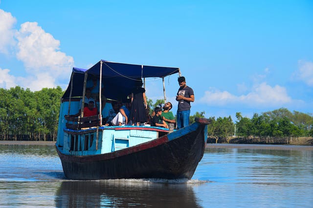
Most tourist visits take the form of multi-day boat trips aboard converted riverboats or launches that serve as floating accommodation while navigating the forest’s main waterways. Typical itineraries range from two to four days, including stops at designated viewing towers such as Kotka, Karamjal, and Hiron Point, where visitors can disembark for guided nature walks along boardwalks (necessary given the risk of both tigers and crocodiles) and observe wildlife including deer, monkeys, and a wide variety of birdlife.
Tiger sightings are rare and should not be expected on a typical trip, given the animals’ elusive nature and the vastness of the forest, though fresh pugmarks are occasionally spotted along muddy banks.
What to Bring
Practical essentials include lightweight, breathable clothing in neutral colors, a hat and sunscreen, insect repellent (mosquitoes are significant around dawn and dusk), binoculars, a zoom lens for photography, and personal medications, since facilities within the forest are extremely limited. Motion sickness remedies are worth packing too, for those unaccustomed to boat travel on tidal waterways.
Responsible Tourism Considerations
Given the ecological sensitivity of the Sundarbans, responsible travel matters. Visitors should choose licensed, reputable operators who follow Forest Department regulations, avoid generating plastic waste, refrain from disturbing wildlife or leaving designated trails, and follow guide instructions at all times, both for safety and for the ecosystem’s wellbeing. Supporting locally owned operators also ensures tourism revenue benefits the communities who live alongside the forest.
Safety Considerations
While incidents involving tourists are rare, the Sundarbans is genuinely wild territory, home to tigers and crocodiles capable of posing real danger. Visitors should never leave designated boardwalks or boats unaccompanied, should follow instructions from the armed forest guards who typically accompany shore excursions, and should expect mobile coverage to be limited or nonexistent within much of the forest.
The Future of the Sundarbans
The long-term outlook for the Sundarbans is a story of both resilience and vulnerability. Mangrove ecosystems have shown remarkable capacity for natural regeneration over geological timescales, and the Sundarbans has survived cyclones, floods, and human pressures for centuries.
Yet the pace and scale of contemporary threats climate change, sea-level rise, upstream water diversion, industrial encroachment, and population pressure represent a fundamentally different order of challenge than anything the ecosystem has previously faced.
Scientific modeling suggests that under moderate to severe climate change scenarios, significant portions of the Sundarbans could experience substantial habitat loss within the coming decades, with corresponding impacts on tiger populations, fisheries productivity, and the storm protection services the forest provides to coastal Bangladesh.
This makes the Sundarbans not just a regional conservation priority but a genuinely global one, given its role in carbon sequestration and its status as a bellwether for how low-lying delta ecosystems worldwide will fare as sea levels continue to rise.
At the same time, growing international attention, strengthened conservation programs, community-based management approaches, and increasing scientific understanding of the forest’s dynamics offer genuine grounds for cautious optimism.
The designation of the Sundarbans as both a UNESCO World Heritage Site and a Ramsar wetland has helped mobilize resources and expertise, while a new generation of Bangladeshi conservationists, researchers, and policymakers continues to push for stronger protections and more sustainable development practices along the forest’s boundaries.
FAQs
Is the Sundarbans only in Bangladesh?
No. The Sundarbans spans both Bangladesh and India, with roughly 60 percent of the forest located within Bangladesh and the remainder in the Indian state of West Bengal, where it is managed as the Sundarbans National Park and Tiger Reserve.
How many Royal Bengal Tigers live in the Sundarbans?
Population estimates vary by survey and methodology, but recent camera-trap based studies in the Bangladesh Sundarbans have suggested a population in the range of roughly 100 to 120 tigers, though ongoing census work continues to refine these figures.
Can tourists see tigers in the Sundarbans?
Tiger sightings are possible but rare, given the animals’ elusive, solitary nature and the vastness of the forest. Most visitors do not see a tiger during a typical multi-day trip, though other wildlife such as spotted deer, monkeys, crocodiles, and a wide variety of birdlife is commonly observed.
What is the best time of year to visit the Sundarbans?
The dry winter months, from November through February, generally offer the most comfortable travel conditions and the best opportunities for wildlife viewing.